Website tells you where great driving roads are if you’re after some fun in your car
If you are looking to have a fun weekend and plan to go for a ride but are struggling to find good driving roads — this website might help you find some pretty exciting routes.
Although Google Maps can get you from point A to point B faster, it might not be as exciting of a ride.
However, there’s a website that helps driving enthusiasts find the curviest and most exhilarating roads around the world.
DISCOVER SBX CARS: The global premium car auction platform powered by Supercar Blondie
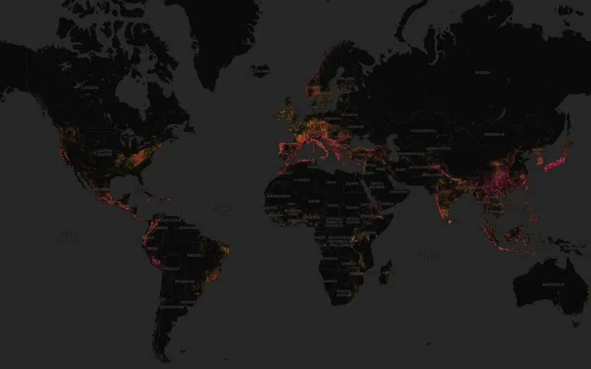
Curvature: A new map app to find the curviest driving roads
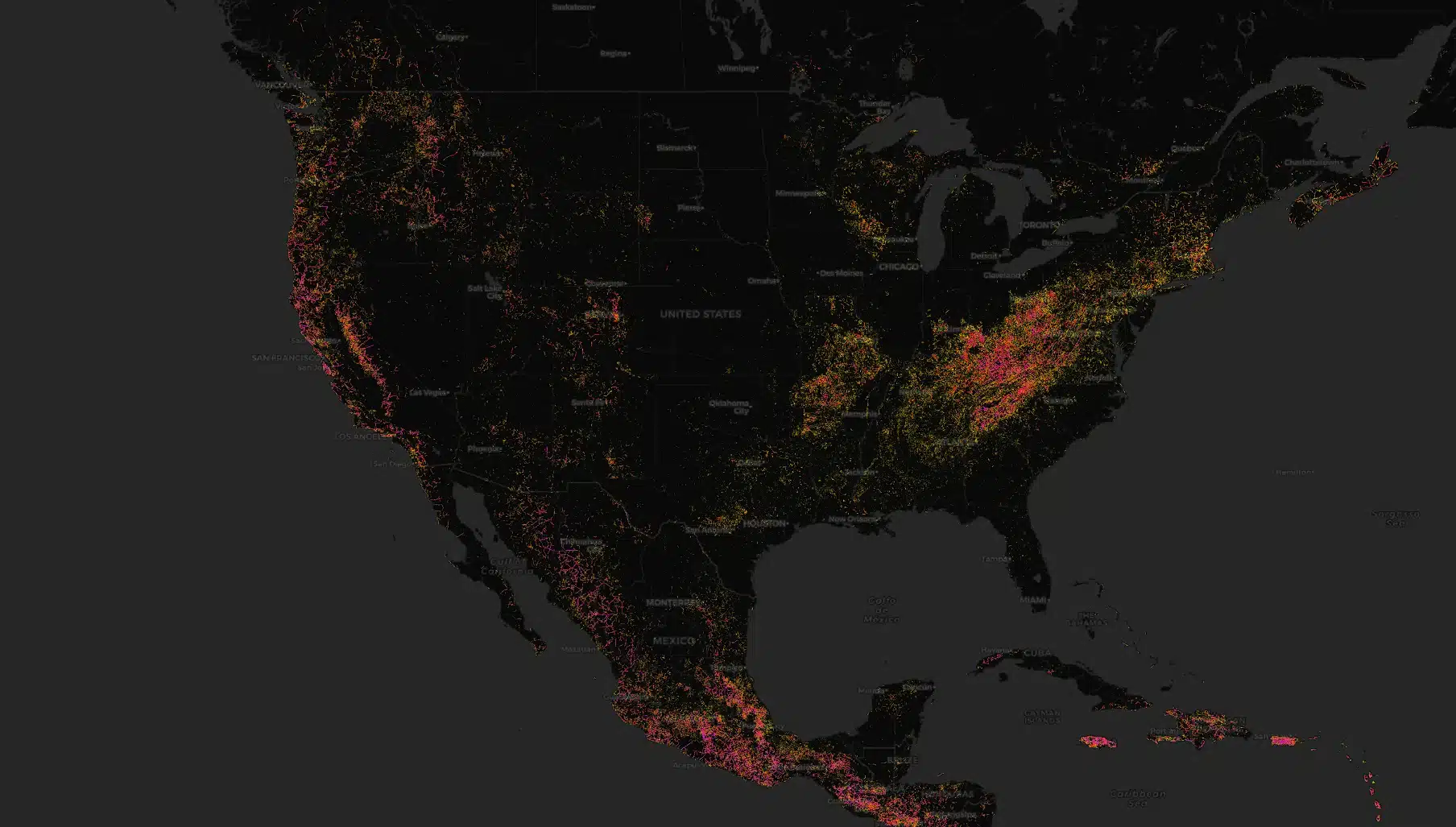
Curvature is a website that provides a Waze-like map for driving enthusiasts to find the curviest roads across the planet.
It features a color-coordinated map highlighting major and minor roads, shows distances between corners, and rates how twisty the route is.
Since not everyone has access to the German Autobahn with no speed limits, the only option left is to find roads within their local cities.
These roads have to be quite secluded, in good condition, nice to drive in, and challenging as well as safe to drive.
Fortunately, Curvature can help you narrow down that search for the perfect driving roads.
How does it work?
The website separates the roads into three colors: yellow, red, and pink.
Predominately straight roads with minimal curves don’t get marked and are considered boring.
Just like this American road that stretches uninterrupted for over 200 kilometers without a single turn.
However, mildly curvy roads are marked yellow on the map.
The red color marks the ‘moderately twisty’ roads, and the hot pink marks ‘very twisty’ roads.
“Curvature helps those who enjoy twisty roads (such as motorcycle or driving enthusiasts) find promising roads that may not be well known,” states the website.
“It works by looking at the geometry of every road segment and adding up how much length of the road is sharp corners, broad sweeping curves, and straight areas.”
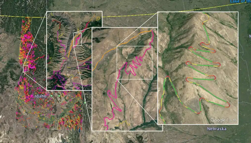
Once you zoom in, the map changes to satellite imagery, so you can check out how the road actually looks.
It is definitely a useful tool that will help you find some of the best driving roads in your area.
Follow topics and authors from this story to see more like this in your personalised homepage feed and to receive email updates.